Southbound To Yankeetown (Florida, That Is!)
I remember my first encounter with the waters near the mouth of the Withlacoochee River. It was the mid-1980s and my Mom and Dad had just moved from St. Pete to Yankeetown. Our boat, a Boston Whaler Montauk, was well suited to drifting the flats off Pinellas Point or for trolling for Spanish mackerel near Mullet Key. Our tackle was light, with the exception of a few baitcasters used to wrangle big Tampa Bay snook. Needless to say, we were totally unprepared for what we would find in the Gulf waters along the lower end of Levy County, only 100 miles from our previous home.
Yankeetown and neighboring Inglis occupy the north bank of the Withlacoochee River between US19 and the Gulf of Mexico. Early on, the area flourished, primarily as a destination for northern hunters and anglers. Later, a small power plant was built upriver and the river and Gulf access channels were dredged to allow access by fuel barges. Now, that plant is gone and the whole area can best be described by two words—‘sleepy’ and ‘fishy’.
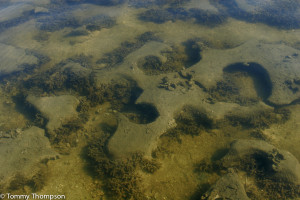
The first things visiting boaters notice about this area are the rocks. I’m not talking pea gravel or smooth, flat river stones. But big rocks—and lots of them! A trip downriver from the small launching ramp near Coast Guard Station Yankeetown on a low tide will give you a good picture of the limestone base that typifies the geology of north central Florida. And these rocks don’t just end where the river leaves the shoreline. Both sides of the dredged channel are littered with spoils, and random rock piles pepper the flats to the north and south of the river. I’ll always be thankful to local guide, Capt. Matt Fleming, for sharing his ‘bad rock’ and ‘hit rock’ waypoints with me.

The rocky spoils dredged up during the construction of two Progress Energy channels and the now-defunct Cross Florida Barge Canal have become the de facto barrier between Crystal Bay and Withlacoochee Bay. The ‘Barge Canal’ is now officially know as the ‘Cross Florida Greenway’ but locally it’s still know by its original name. Those channels, along with a long line of bars that parallel the coastline, are responsible for some pretty good fall fishing south of Yankeetown. Navigating these waters can be tricky, but don’t be fooled into complacency when you see locals zigzagging in their boats near the coastline. Most of them know the location of each and every bar and rock pile. A simple (and safer) course to the spoils is to leave the mouth of the Withlacoochee, go to marker #18A and then head south to waypoint N28 58.326 W82 47.790. That puts you in the middle of the Barge Canal channel, giving you good access to those spoils. If you’re heading on to the power plant channel spoils, head southeasterly from there to Fishermans Cut (N28 56.600 W82 46.532). As the spoil islands are dredged, there’s pretty good water right up to their rocky edges. While all of the islands have great fishing potential this month, I’d head to the last two islands to find the best action. Here, along the spoil edges near Long Point (N28 55.996 W82 49.326), use live pinfish on slip-sinker rigs or deep-running D.O.A. Bait Busters for seatrout and redfish. Also, be sure to keep a brightly colored jig handy just in case a school of Spanish mackerel appears. The spoil banks on both the Barge Canal and Progress Energy canals run all the way to the natural shoreline. Inshore anglers, particularly those who enjoy fishing topwater lures, might concentrate on Trout Creek and Johns Creek during high water on cool, sunny days. Those creeks flow into the Barge Canal from the north, just outside it’s mouth. Another popular area is Rocky Cove, an area tucked in between the power plant discharge spoil and the north side of the intake channel. Pay particular attention to the flats outside and the sloughs between the rows of bars just inside Rocky Point (N28 57.530 W82 44.571), at the tip of the discharge spoil. Here, expect to find mostly trout and reds. Reaching the area isn’t too hard on higher water—just hug the northern bank of the intake spoil eastward from Fishermans Cut. Just don’t be in a hurry!

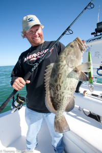
Yankeetown is also a good departure point for some near shore fishing for offshore species. The marked channels—Withlacoochee River, Barge Canal and Progress Energy—all have been, at some time in their recent history, dredged. And that process did a nice job of producing some pretty rough edges, especially on the deeper channels. If the weather’s nice, run out the Barge Canal to its junction with the Progress Energy channel. There, troll big, lipped plugs to the southeast up the Progress Energy channel to marker #28. Pull them close to the south side of the channel for the best chance of a grouper bite.


3 comments on “Southbound To Yankeetown (Florida, That Is!)”
This Matt Fleming guy, I have heard of him, He is a legend down there, at least that is what I heard……………..
where can we buy fresh shrimp and sea by the pound.
Closest and best seafood to Yankeetown is likely in Cross City, at Rick’s. Address: 261 SW 12 St, Cross City, FL 32628
Phone:(352) 498-3819