Tide Creek
Levy Bay Boat Ramp, Levy Bay Road, Panacea, FL, USA
http://fdep.maps.arcgis.com/apps/MapTour/index.html?appid=11c142503eb142a2939c67a397104794
Add To Trip Planner Directions
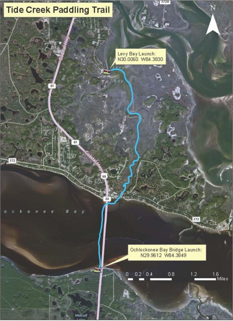
Overview: Begin at Levy Bay Boat Ramp. Head south through Tide Creek, passing under Mashes Sands Bridge into Ochlockonee Bay. Upon entering the Bay, head west, passing under the Ochlockonee Bay Bridge, then cross the Bay (1 mile) to the other side. End at Ochlockonee Bay Boat Ramp in Franklin County.
Considerations: Sheltered and tidal, best taken on a high, outgoing tide. The first 2 miles are protected and winding. The last mile, across Ochlockonee Bay, is in open water, which can be choppy if it’s windy.
Focus: Explore the vast tidal marsh system. Birding is very good, including Great Blue Herons, Great and Snowy Egrets, Clapper Rails, Harriers, and Marsh Wrens.
Distance: 3.5 miles, 3 hours. It is 2 miles from the launch site to Ochlockonee Bay.
Put In: Take US 98 south through Panacea. Turn right (east) onto Chattahoochee and left on Levy Bay Road. The boat ramp is at the end of the road with restroom, benches, and parking. Launch on sand next to ramp.
Take Out: At the Ochlockonee Bay Boat Ramp in Franklin County, located at the south end of the Ochlockonee Bay Bridge, with restrooms, trash cans, and parking. There is easy entry next to the floating boat dock.
Expertise: Intermediate and up.
The following map and trail guide are provided courtesy of Florida Department of Environmental Protection, Florida Coastal Management Program, the Wakulla County Tourist Development Council and the Florida Department of Economic Opportunity.
Click here for trail map and guide.
Disclaimer: The Original Florida Tourism Task Force (dba VisitNatural Nroth Florida) and the North Central Florida Regional Planning Council do not warrant the accuracy or timeliness of this map and paddle guide or the safety of this trail for use by paddlers. Paddlers should use this trail only if they have the adequate skill level and dquipment, and paddlers must make that determination. Paddlers should also check weather forecases and wter levels in advance to avoid any unnecessary danger. The Original Florida Tourism Task Force, the local governments in which this paddling trail is located and the North Central Florida Regional Planning Council are not responsible for any damages whatsoever from its use.


