Head Down Dixie County’s ‘Road to Nowhere’ For Some Excellent Paddling
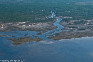
Dixie County’s ‘Road to Nowhere’ is the southern extension of CR361 that runs from Casey’s Corner in Jena (just across the river from Steinhatchee) and dead ends about 12 miles south, inshore of the Pepperfish Keys. If you’re traveling from the south, come to Jena via CR358 from US19/98 and bear left onto CR361 when you get to the flashing light at Casey’s Corner. If you’re traveling from the north, come to Steinhatchee via CR51 from US19/98 at Tennille. Once you pass the US Post Office, turn right onto 2nd Avenue. Then, turn left on 10th Street, cross the bridge and turn left at the dead end. That’s CR358 which will lead you Casey’s Corner. There, turn right onto CR361–the Road to Nowhere.
There are four primitive boat launches on this stretch of road. All are in creeks with good access to the Gulf for small boats. Small motorized boats, airboats and paddle craft all find the sand ramps uesable.
The Pine Log ramp is maintained by the Florida Fish and Wildlife Conservation Commission and is located inside the Jena Wildlife Managment Area. The dirt road, known locally as Sand Ridge Road, takes off from Rocky Creek Cutoff Road. It’s about a 3 mile trip to the ramp from the main road. Rocky Creek Cutoff Road is located about a mile south of Casey’s Corner. Take the first right past the Jena Baptist Church, then make the first left into the WMA. This ramp gives excellent access to Porpoise, Pine Log, Howard and Goose Creeks. Parking is limited.
The Rocky Creek Ramp is located just west of the Rocky Creek community on the north side of the creek. It’s about 5 miles from Casey’s Corner to Rocky Creek and SW 459th Avenue. Turn right and follow it to the ramp. Here, it’s a short paddle to the Gulf and some rocky shoreline. Parking is adequate.

Sink Creek Road is about a mile south of the Rocky Creek bridge. There’s a small sign, and you’ll take the road to the headwaters of a small creek. There’s plenty of parking here, but the creek is shallow. At times, you’ll see a small spring boiling next to the dirt boat ramp.
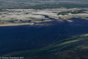
Cow Creek is about 3.5 miles south of the Rocky Creek bridge. From here, it’s an easy paddle to the Gulf and to the waters behind the Pepperfish Keys. It’s advised you plan your trip around the tides, as many areas go dry at lower tides. Parking is along the roadside here, as the ramp is beside the small bridge of the creek.

If you’re a paddler or paddle fisher or just a fisher, don’t miss these beautiful waters. This is an area of Original Florida that has never changed–and likely never will!

